Five Days, Almost No Sleep, and Nowhere Near Enough Time
Iceland had been high on my list for a long time, and this trip was going to be even better because my friend and neighbor David was coming with me. We had spent years shooting sports and other photography together, so having another photographer along meant I wasn’t going to be the guy constantly saying, “Give me five more minutes.” He understood five minutes usually meant thirty.
He shoots Nikon, but I’ve learned to overlook character flaws.
We actually started the trip together at RDU in the American Airlines lounge, but we weren’t flying together. I was on American and David was flying Delta. Somewhere along his route things went sideways and he got stranded overnight during his connection. I didn’t even know that had happened until after I landed in Iceland.
So there I was at Keflavík with a rental car, a ridiculous amount of camera gear, one missing photographer and no intention whatsoever of wasting a day in Iceland.
That pretty much set the pace for the rest of the trip.
Fair warning: this one is photo-heavy. Iceland gave me far too many great shots to pretend I was going to keep this page short. I could have trimmed it down, but honestly, that would defeat the point.
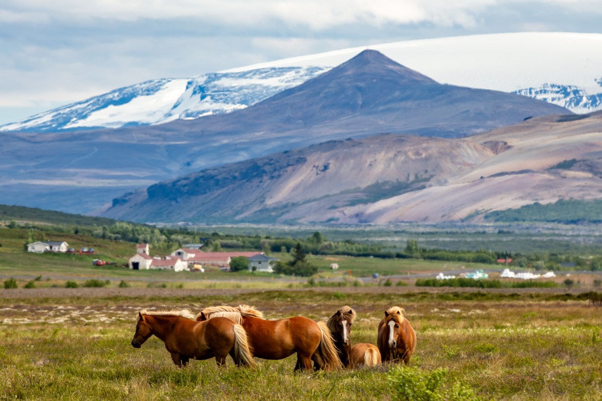
A small group of Icelandic horses gathers in an open pasture beneath the wide Icelandic sky.
Sunlight brightens the green cliffs surrounding Skógafoss as mist rises from the base of the waterfall.
A wider view follows the rugged volcanic cliffs toward Svörtuloft Lighthouse above the North Atlantic.
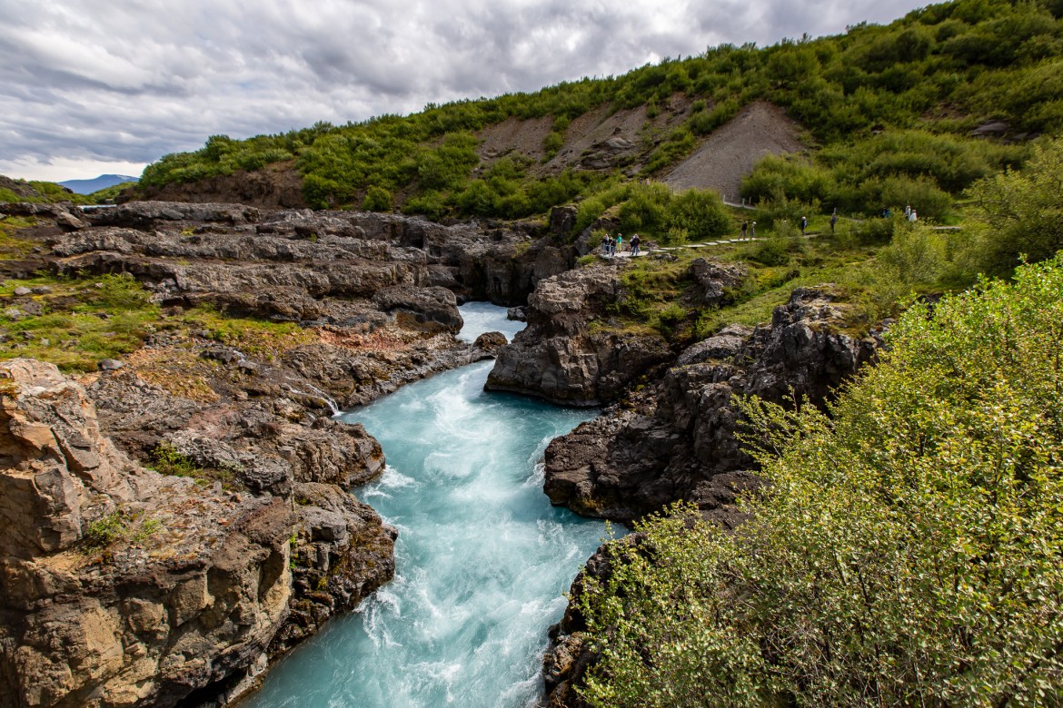
The Hvítá River funnels between dark lava walls at Barnafoss before widening again downstream.
A rainbow forms in the spray beneath Seljalandsfoss as sunlight reaches through the falling water.
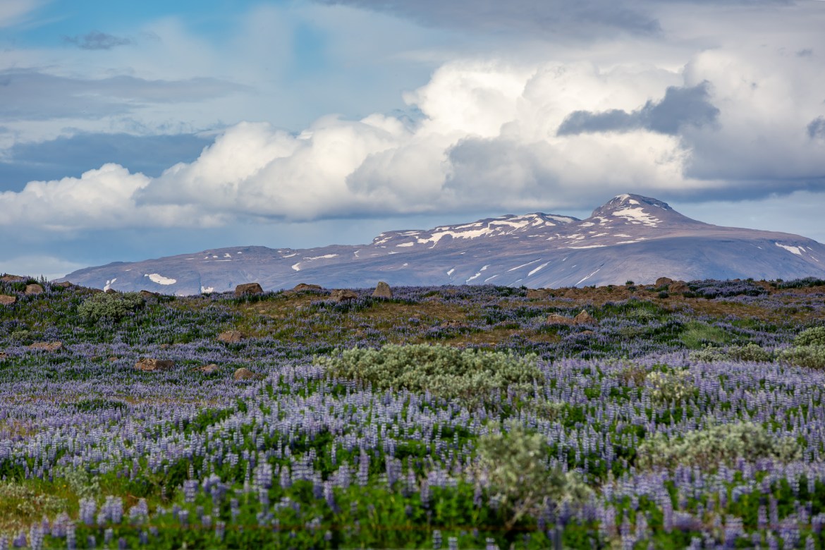
Purple lupines stand in full bloom during Iceland’s short summer season near the Golden Circle.
From above, Gullfoss pours through multiple tiers before disappearing into the narrow Hvítá River canyon below.
Journey Timeline
Day 1: KEF → Airbnb near Laugarás → Geysir/Strokkur → Gullfoss → Brúará area → Faxi → Skálholt → Laugarás
Day 2: Laugarás → KEF to pick up David → Grótta → Reykjavík/Harpa → Seljalandsfoss → Skógafoss → Dyrhólaey → Reynisdrangar/Vík
Day 3: Laugarás → Þingvellir/Öxarárfoss → Glymur area → Hraunfossar & Barnafoss → Kirkjufell/Kirkjufellsfoss → Snæfellsnes
Day 4: Snæfellsnes → Svörtuloft → Malarrif → Arnarstapi/Gatklettur → Búðakirkja → Golden Circle return → Gullfoss → Geysir → Brúará → Brúarfoss → Laugarás
Day 5: Laugarás → Keflavík → home
The Experience, Told Through the Journey
Day 1 — Iceland Without David
The first surprise was the rental car.
I don’t remember what model it was, other than it being very compact, but I definitely remember the rental-car counter. They did a pretty effective job of explaining all the ways Iceland could destroy their car and how expensive that could become. Gravel, weather, road conditions, damage far from home—it was enough that I bought considerably more coverage than I normally would.
It was cool, but nowhere near the brutal cold people sometimes associate with Iceland. What surprised me more was the landscape. I had expected to immediately see a lot more green, but the area around Keflavík was much more volcanic than I pictured. Rock, lava and open terrain dominated that first drive.
With David still trying to figure out whether he could get to Iceland the following day, I headed toward the Airbnb near Laugarás.
Google Maps took me right to it. The place was smaller than I expected and more expensive than most Airbnbs I had stayed in, but that quickly became another lesson about Iceland: everything cost more.
The owner came out, showed me around and even invited David and me to have dinner with him and his wife. There was also a hot tub outside.
Nice feature but absolutely no chance I was going to spend my limited Iceland time sitting in it.
I unpacked my clothes, organized the camera equipment, grabbed what I needed and headed right back out.
Geysir and Strokkur
I had planned some of the major stops before leaving home, but I certainly hadn’t researched everything to death.
Strokkur was on the list because it was one of the places you were supposed to see. Beyond that, I really didn’t know much about the timing of the eruptions or exactly what to expect.
It wasn’t crowded. In fact, a lot of the people around me seemed to be doing exactly what I was doing—waiting with cameras.
I put one of the 5D Mark IIIs into high-speed burst, kept my finger on the shutter and had my phone ready to record video.
Then the thing erupted.
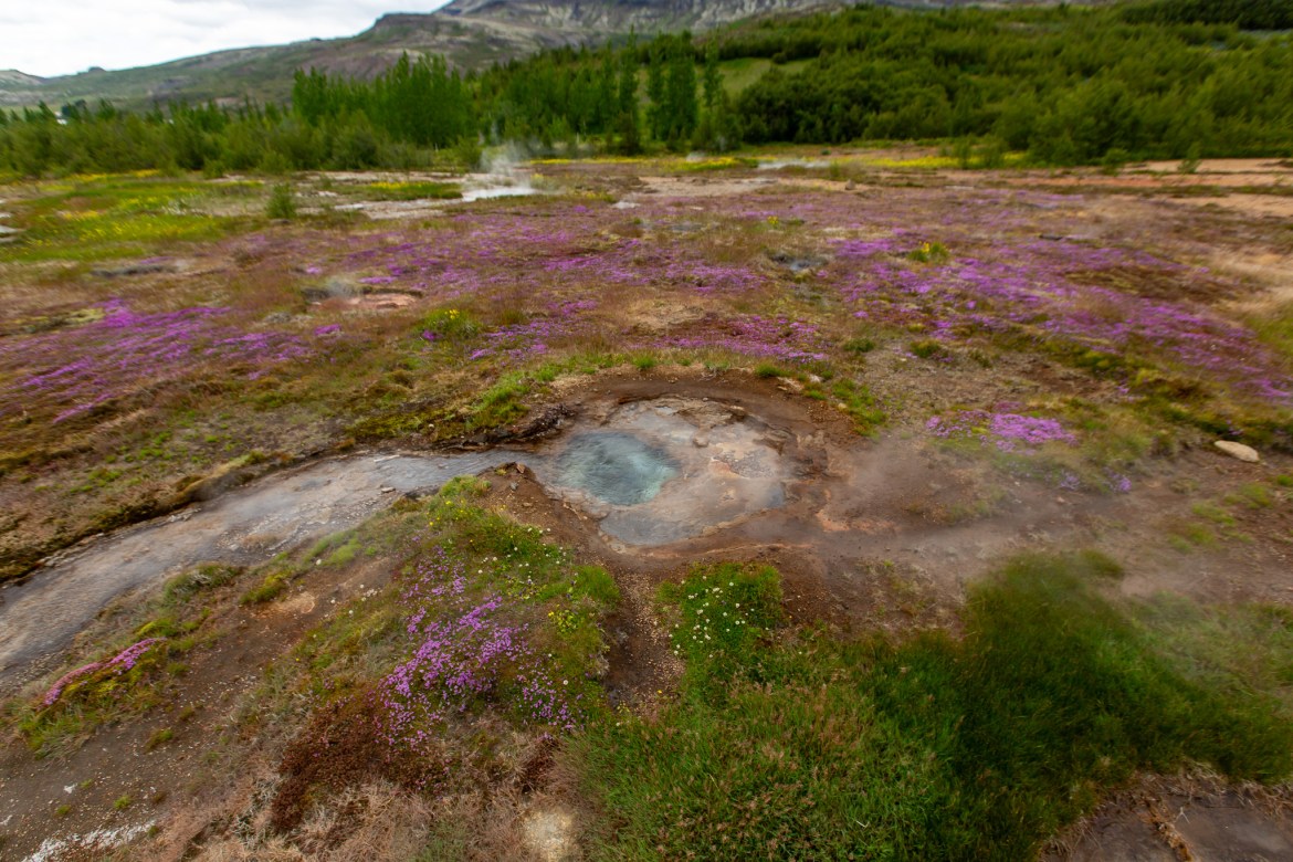
I had never experienced anything quite like the geothermal landscape around Geysir. The steaming ground, blue pools, mineral colors and then Strokkur suddenly sending water into the air were completely different from anything I had photographed before.
I hadn’t even been to Yellowstone yet, so I had nothing remotely comparable in my own travels.
Öxarárfoss descends between the fractured cliffs of Þingvellir, surrounded by the exposed geology of Iceland’s rift valley.
Brúarfoss spreads across the dark riverbed before converging into the vivid blue channel that gives the waterfall its distinctive appearance.
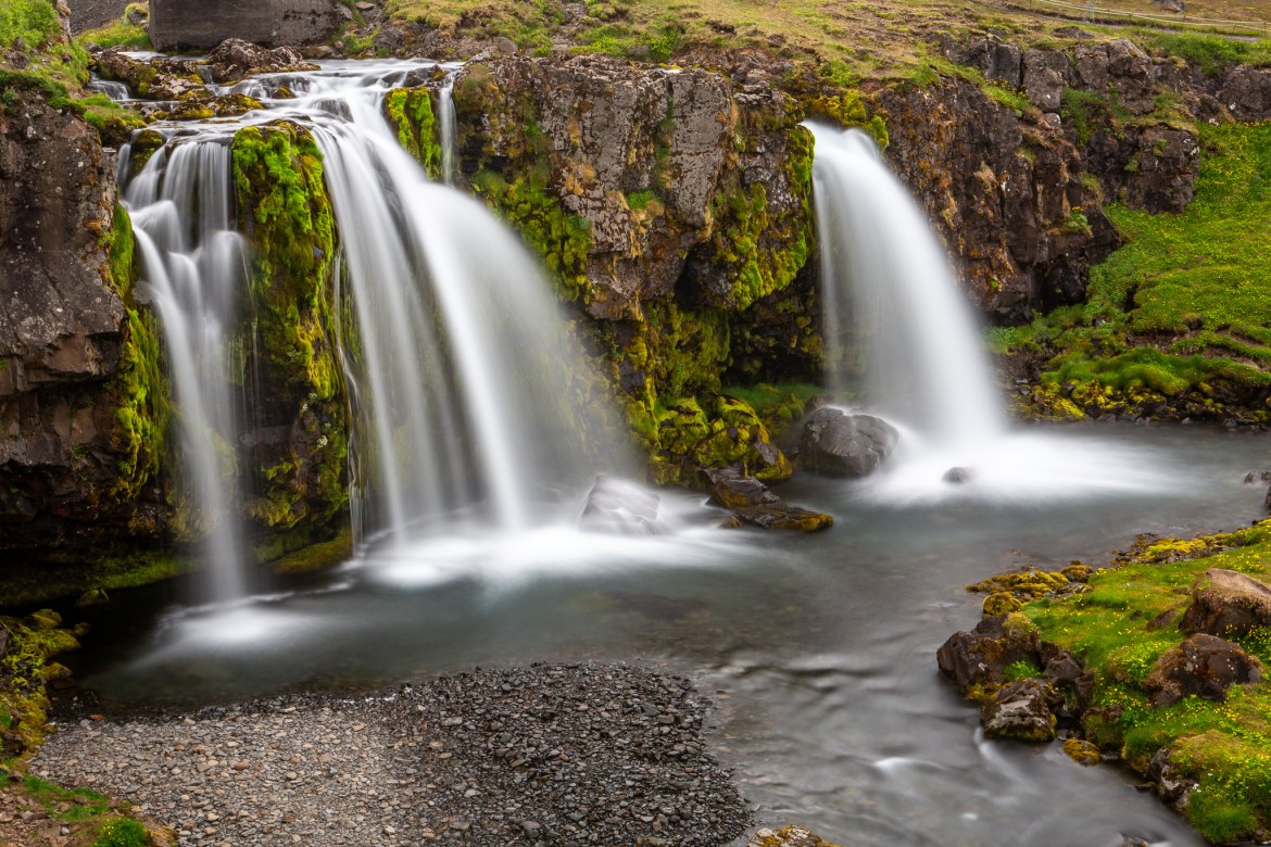
Kirkjufellsfoss flows beneath Kirkjufell in one of the most recognizable landscapes on the Snæfellsnes Peninsula.
The Experience, Told Through the Journey
Gullfoss
Gullfoss was different. The strange part was how hidden it initially felt. Niagara Falls lets you know it is there. Everything is built around it and the attraction announces itself well before you ever reach the edge.
Then suddenly there is this enormous amount of water disappearing through the landscape.
The clouds weren’t what I wanted. I had the postcard image in my head with beautiful skies and perfect light, and instead Iceland gave me gray.
But seriously—how disappointed can you be standing at Gullfoss?
I walked all over the viewing areas looking for different angles, changed lenses constantly and got the drone into the air for views I couldn’t get from the ground.
Farther away from the falls I started seeing huge areas of purple lupines along the walking areas. They immediately grabbed my attention. Waterfalls were one thing, but these enormous patches of purple flowers against the green and volcanic landscape were something I hadn’t expected.
That became another pattern for the trip: the famous destination might get me there, but something completely different would make me stop the car or change lenses.
Whatever Was Along the Road
Driving around Iceland with cameras in the car became dangerous to the schedule.
I was constantly looking out the window for something to photograph. Horses., sheep, rams, cattle, farms, mountains, lupines, another waterfall, some weird piece of volcanic rock…stop the car.
Outside Reykjavík, traffic was almost nonexistent compared with what I was used to. I could drive for quite a while without seeing another vehicle, which made spontaneous photography stops much easier.
At one point I flew the Mavic over a group of Icelandic horses from a fairly high altitude. They clearly weren’t thrilled about it, so I stopped and kept the drone farther away after that. Landscapes weren’t going to care about my drone. The horses did.
Faxi and Skálholt
Faxi was one of those stops that stuck with me because it felt almost absurdly quiet.
Here was this waterfall sitting out in the Icelandic countryside and essentially nobody was there. Back home there would have been barriers, crowds, parking problems and probably somebody selling a $9 bottle of water.
Here I pretty much had it to myself. I photographed it from several positions, flew the drone and made a few photos of myself with the waterfall behind me.
Skálholt was close enough to the Airbnb that it made an easy stop as I worked my way back. The large white cathedral was impossible to miss, but the turf-covered historic building beside it was what really caught my attention. I flew the drone there too and spent some time wandering around the grounds and cemetery.
By then the sun was getting lower. Sort of. June in Iceland does strange things to your internal clock. There was so much usable light that I never really felt pressure to stop. If anything, the light became an excuse to keep going.
Sleep could wait. Eventually I made it back to the Airbnb and got a few hours. That was enough.
A shaggy Icelandic sheep pauses on a rocky slope surrounded by sparse summer vegetation.
The black wooden Búðakirkja stands alone at Búðir beneath low clouds, with the rugged Snæfellsnes landscape stretching behind it.
A vivid blue geothermal pool steams beneath the overcast sky in Iceland’s Geysir Geothermal Area, surrounded by mineral-stained ground and runoff channels.
The Experience, Told Through the Journey
Day 2 — Photographer Number Two Finally Arrives
The next morning I knew David was finally going to make it.
I drove all the way back to Keflavík to get him, and once he and his Nikon gear were recovered we did exactly what two rational people operating on very little sleep should do.
We immediately started sightseeing.
We didn’t even bother returning to the Airbnb.
David was every bit as excited as I was, so adrenaline handled whatever sleep had failed to provide.
Grótta, Harpa and the Reykjavík We Barely Saw
Grótta wasn’t some massive planned attraction. Neither was Harpa.
They were simply interesting places we could work into the route while seeing at least a little of Reykjavík before heading back out.
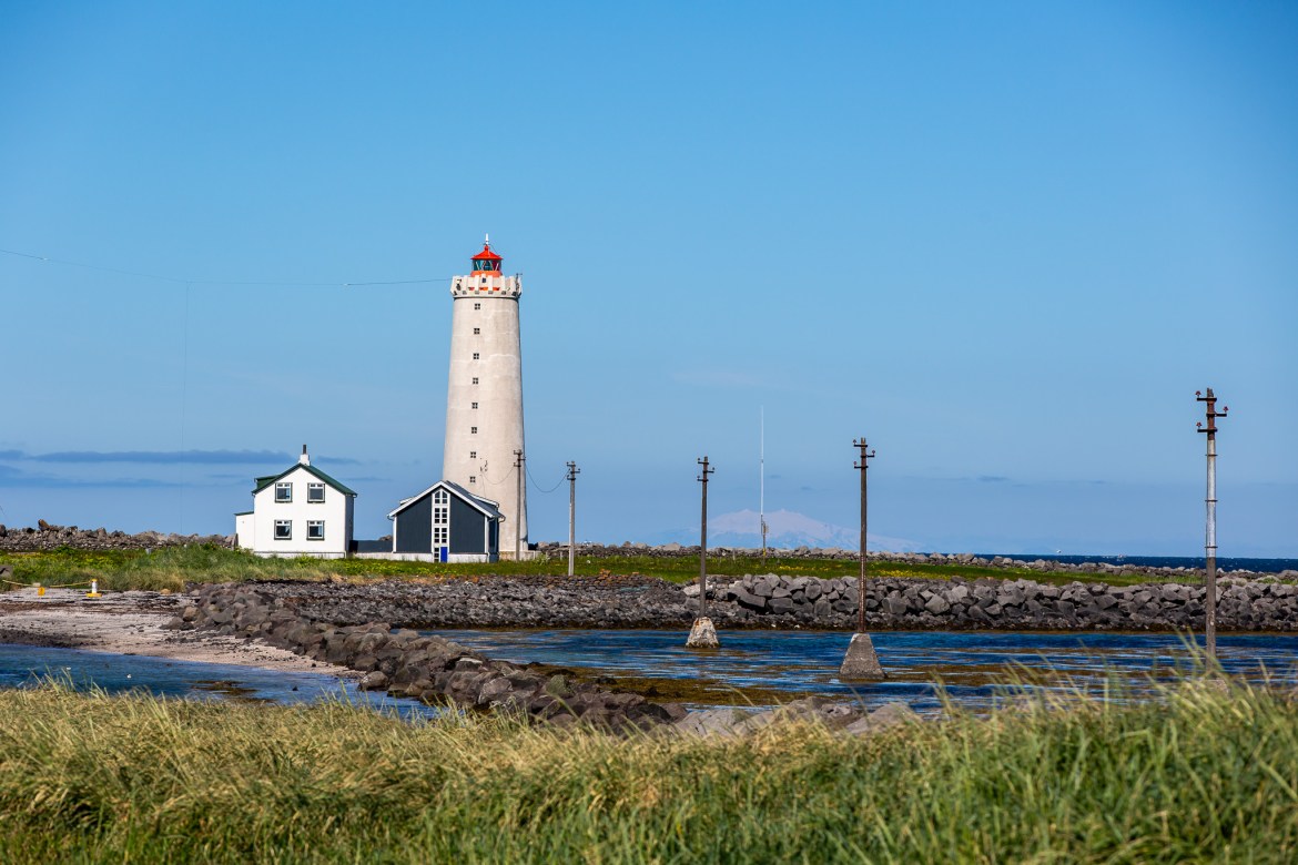
Grótta gave us coastline, the lighthouse, birds and tidal landscape. Harpa gave us the opposite: modern architecture and that geometric glass exterior.
Looking back, Reykjavík is one area where our lack of planning hurt us.
We missed Hallgrímskirkja completely.
We also skipped the Blue Lagoon area.
That sounds ridiculous now, but we weren’t in Iceland for spas and city sightseeing. We had cameras and a country full of waterfalls.
Priorities.
South Coast
Once we left Reykjavík, the trip shifted into exactly what both of us had come for.
Seljalandsfoss was impossible to miss.
The waterfall drops from this enormous green cliff with a recessed area behind it, and the trail actually takes you around and behind the falling water.
There was no way I wasn’t doing that.
I got wet.
The cameras got damp.
Worth it.
The photographs looking through the curtain of water toward the surrounding countryside—and especially the rainbow forming in the spray—made being soaked irrelevant.
Then came Skógafoss.
Skógafoss doesn’t sneak up on you like Gullfoss. It basically punches you in the face.
The scale of the waterfall, the cliffs and the amount of spray at the bottom immediately commanded attention. Fortunately it wasn’t terribly crowded and we had plenty of room to work.
We moved closer, got into the mist and worked the rainbow that formed near the base.
My only regret is that we didn’t climb the staircase to the top.
By that point we were exhausted, and looking up at all those steps suddenly made the view from the bottom seem perfectly acceptable.
I wish we had done it anyway.
Dyrhólaey, Reynisdrangar and Game of Thrones
I was a huge Game of Thrones fan.
Well, until the ending.
I knew Iceland had been used extensively during filming, so several areas had an extra layer of interest for me. Þingvellir was part of that, but the South Coast around Dyrhólaey and Reynisdrangar was another.
We walked around photographing the cliffs, sea arch, coastline and stacks. The sun wasn’t always where we wanted it, which is one of those things photographers complain about as if the planet should adjust itself because we brought tripods.
It didn’t.
We shot it anyway.
By the time we finally worked our way back toward the Airbnb, we had been going for what felt like another full day and a half.
That became normal.
Seljalandsfoss rises beyond a meadow of yellow flowers, with mist drifting beneath the dark volcanic cliff.
Spray rises from the lower plunge of Gullfoss as the Hvítá River disappears into the narrow canyon below.
Bright summer sun reflects across the North Atlantic from the rocky coastline at Dyrhólaey.
The Experience, Told Through the Journey
Day 3 — West Iceland and Water That Didn’t Look Real
Þingvellir was fascinating before I even started thinking about the history.
The dark volcanic rock was covered in patches of moss that looked almost unnaturally green. Against the black stone, the color seemed to glow.
Öxarárfoss gave us another waterfall to work, but the surrounding landscape was just as interesting. We moved around with the tripods, experimented with different compositions and used the second cameras on timers for some of the photos of ourselves actually working the scene.
From there we pushed west.
Hraunfossar and Barnafoss
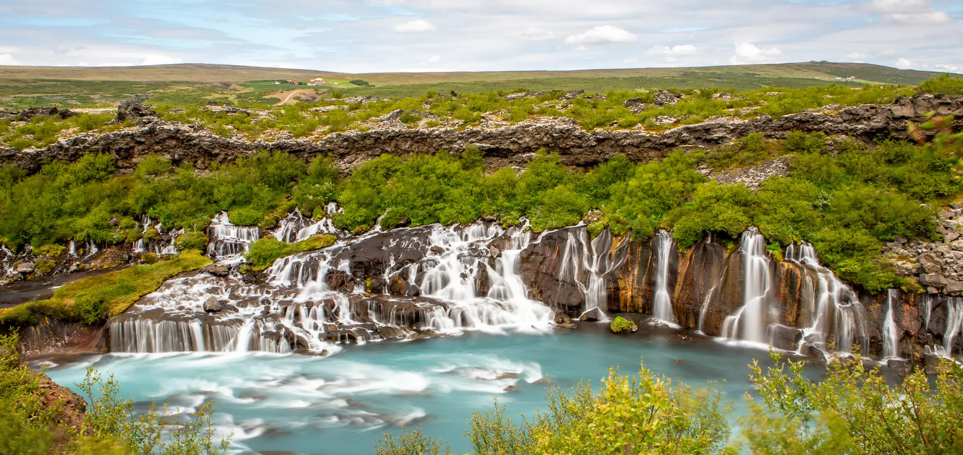
Hraunfossar ended up being one of my favorite places in Iceland.
The water didn’t look real.
Not after Lightroom.
Not after editing.
Standing there.
The turquoise color against the dark volcanic rock and green landscape was ridiculous.
Instead of one huge waterfall, Hraunfossar spread through the landscape in countless smaller streams before entering the river. Right nearby, Barnafoss compressed that same brilliant water through a much tighter volcanic gorge.
We spent hours in this area.
Every few feet gave us another composition, and we finally had some breaks in the clouds that allowed blue sky into the photographs.
I could have stayed much longer.
Kirkjufell
Kirkjufell and Kirkjufellsfoss were different because this was one of the photographs I already knew.
It’s one of Iceland’s most recognizable landscapes, and getting my own version was absolutely on the agenda.
Naturally, Iceland gave us clouds again.
Fine.
Out came the filters and tripods.
We worked longer exposures to smooth the water at Kirkjufellsfoss and let some movement enter the clouds instead of fighting the conditions.
Sometimes you get the sky you planned.
Sometimes you photograph the sky you got.
Deeper into Snæfellsnes
The farther we went onto the Snæfellsnes Peninsula, the more Google Maps became entertainment.
There were times when we looked at the road and genuinely questioned whether Google had decided we should just create one ourselves.
But somehow it kept getting us where we wanted to go.
We traded driving duties, photographed constantly and grabbed the occasional nap whenever we weren’t the one behind the wheel.
Normal vacation behavior had pretty much left the building.
A rugged volcanic outcrop rises beyond a broad field of purple lupines in the countryside near Vík.
Gullfoss surges through the Hvítá canyon as mist rises above the lower falls and green cliffs frame the river.
A powerful eruption of Strokkur sends water high above the geothermal field along Iceland’s Golden Circle.
The Experience, Told Through the Journey
Day 4 — Forget the Clock
At some point the distinction between late night and early morning became meaningless.
Svörtuloft is a perfect example.
We deliberately headed out toward the orange lighthouse and surrounding lava coast, then hiked through the volcanic terrain looking for angles that brought the lighthouse, cliffs and Atlantic together.
The cliffs were spectacular.
They were also covered in an unbelievable amount of bird crap.
Nobody puts that part in the Iceland brochures.
I used the drone heavily here because the coastline was perfect for it. From above, the orange lighthouse against the black volcanic terrain and ocean was exactly why I had hauled the Mavic all the way to Iceland.
We continued around Snæfellsnes through places like Malarrif, Arnarstapi and Gatklettur before reaching Búðakirkja.
The little black church had been another intentional stop.
What I remember most was the light. The sun was about as low as I had seen it on the entire trip and it was still nowhere close to what I would call dark.
Iceland simply refused to turn the lights off.
Somewhere in all of this we actually ate a real meal at Sker Restaurant in Ólafsvík, which apparently proves food did occasionally make the itinerary.
Most of the time we seemed to survive on fruit, bars and adrenaline.
Back to the Golden Circle
We eventually worked our way back toward the Golden Circle so David could see some of the places I had already photographed during my first solo day.
That meant another chance at Gullfoss and Geysir.
I didn’t mind repeating either one.
Photography changes once you’ve already seen a location. The first visit is mostly reaction—everything is new and you shoot everything. The second time you already have some idea where you want to stand and what you want to do differently.
Then came Brúarfoss.
And Google finally betrayed us.
Brúarfoss — This Is Probably Not the Trail
Brúarfoss was one of the locations both of us had really wanted to photograph.
We followed Google Maps toward what we thought was the access, parked near a sign pointing toward Brúarfoss and started hiking.
The problem was that access in this area had changed.
The old path had been closed the year before after problems with visitors crossing private property and blocking access around nearby vacation homes.
We found that out the practical way.
At some point our “trail” involved going over a fence and continuing through what was clearly no longer the public route.
We looked at each other.
We looked at the river.
We kept going.
Not one of our brighter decisions.
Once we reached the Brúará, though, the photography was incredible.
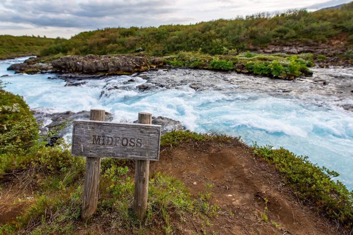
The water was that same almost unbelievable turquoise color we had seen elsewhere, except here we were following it upstream through Hlauptungufoss and Miðfoss toward Brúarfoss.
In places there wasn’t much separating us from fast-moving water and volcanic rock. There were definitely sections where slipping would have been a very bad idea.
We spent hours out there.
Cameras.
Tripods.
Long exposures.
Video.
Drone.
Move fifty feet and do it again.
I probably used the Mavic here more than almost anywhere else on the trip.
Then we reached Brúarfoss and discovered people arriving from another direction.
The correct direction.
Well, that was useful information.
Unfortunately our rental car was parked more than two miles back where we had started, which meant there was no easy option except returning the same way we came.
Lesson learned.
At least the photographs were worth it.
The bright orange Svörtuloft Lighthouse stands against the dark lava landscape on the western edge of the Snæfellsnes Peninsula.
Purple lupines crowd the riverbank beside the road bridge crossing the Brúará in South Iceland.
Faxi Waterfall stretches across the Tungufljót River beneath heavy Icelandic clouds during my first day exploring the Golden Circle.
The Experience, Told Through the Journey
Day 5 — Leaving With Half the Country Still on the List
We eventually returned to the Airbnb and slept for a few hours before packing everything back into the little rental car.
I don’t think either of us had gotten anything resembling a normal night’s sleep the entire trip.
We didn’t care.
Between the two of us we had spent days trading driving duties, shooting until ridiculous hours and occasionally sleeping in the passenger seat while the other person kept moving.
Iceland had somehow given us good weather for almost the entire visit. Cool, yes. Windy at times, absolutely. But nothing that stopped us.
What did stop us was the calendar.
We had to leave.
And after everything we had covered, I still felt like we had barely started.
The northern part of Iceland remained untouched. Most of the Ring Road was still waiting. There were places we skipped because we didn’t know enough about them and places we simply couldn’t squeeze into five days.
I knew before leaving that I’d be back.
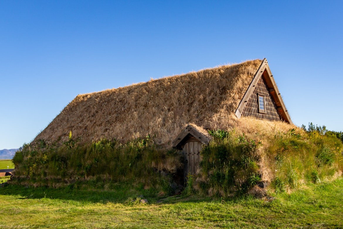
Skálholt Cathedral stands beside the turf-covered Þorláksbúð, bringing two very different periods of Icelandic architecture together in one view.
The turquoise Brúará cuts through the dark riverbed as the route continues upstream toward Brúarfoss.
Spring water emerges through the edge of the lava field and tumbles into the Hvítá River at Hraunfossar.
A vertical composition follows Öxarárfoss from the top of the cliff down through the rocky stream below.
A close portrait captures the long mane and calm expression of an Icelandic horse against a softly blurred landscape.
The orange Svörtuloft Lighthouse rises beyond the jagged black cliffs and blue water of the Snæfellsnes coast.
From behind Seljalandsfoss, sunlight breaks through the falling water while the South Iceland landscape opens beyond the cliff.
Food, Drinks & Quick Stops
Calling this a food-focused trip would be one hell of a stretch.
David and I regularly spent 18 hours or more moving around, and somehow eating became optional. I remember fruit, food bars and whatever we could find when something happened to be open.
Restaurants outside the larger areas seemed surprisingly scarce, and many places closed much earlier than we expected. Gas stations weren’t nearly as frequent as I was accustomed to either, which made fuel stops something you didn’t put off simply because the gauge said you still had plenty.
One meal I do remember was Sker Restaurant in Ólafsvík during the Snæfellsnes portion of the trip. Apparently even two photographers running on adrenaline eventually have to sit down and eat actual food.
Our Airbnb owner had also invited us to dinner with him and his wife when I arrived, which was an incredibly nice gesture.
We never slowed down long enough to take him up on it.
Dinner at Sker Restaurant in Ólafsvík gave David and me a break from the road while we worked our way around the Snæfellsnes Peninsula.
Nothing says Iceland like a pylsa in hand—simple, iconic, and irresistibly tasty.
From Iceland’s icy waters to your plate — buttery salmon served with a crispy baked potato and fresh garden greens.
Sweet, tender langoustine — Iceland’s ocean treasure paired with rustic bread and nutty greens.
In the Frame
The Faces Behind This Journey
Gullfoss and the Hvítá River canyon behind me during my first day exploring Iceland.
At the base of Skógafoss with the bright green cliffs and one very impressive wall of water behind me.
David and I beside the vivid blue Hvítá as it rushes through the rocky gorge at Barnafoss.
Working the rocks around Öxarárfoss with the second camera running on a timer.
Right beside Seljalandsfoss as a rainbow formed through the spray at my feet.
Above the narrow turquoise channel of the Brúará near Hlauptungufoss.
Surrounded by purple lupines during my first day on the Golden Circle.
A tucked-away Selvallafoss along Route 56 on the Snæfellsnes Peninsula.
Another look at Gullfoss, this time with the upper falls rushing through the canyon behind me.
Steam drifting across the geothermal field at Geysir while I wandered through one of the strangest landscapes I had ever seen.
Above the black volcanic cliffs at Svörtuloft with the orange lighthouse across the coastline.
In the mist below Skógafoss with a rainbow cutting through the spray beside me.
Timer set, camera on the tripod, and the turquoise Brúará flowing past the rocky bank behind me.
Taking a break among the moss-covered lava formations under Iceland’s seemingly endless summer daylight.
Where I stayed
Our base was a small Airbnb near Laugarás, which turned out to be a great location for the way we were traveling.
It was smaller than I expected and certainly more expensive than similar places I’d rented elsewhere, but it was clean, comfortable and positioned well for the Golden Circle and our constant runs in different directions.
The owner personally greeted me when I arrived, gave me a tour and invited David and me to dinner with him and his wife.
There was even a large outdoor hot tub.
We never used it.
That pretty much sums up this trip.
The Airbnb was where we stored gear, showered and occasionally slept.
Iceland was outside.
The simple living room at our Airbnb became home base between some very long days photographing Iceland.
The kitchen in our Golden Circle Airbnb gave David and me a practical home base for the trip.
The dining and living space inside the Airbnb David and I shared while exploring Iceland’s Golden Circle and South Coast.
Our Airbnb had a wide view across the surrounding South Iceland countryside from the kitchen and dining area.
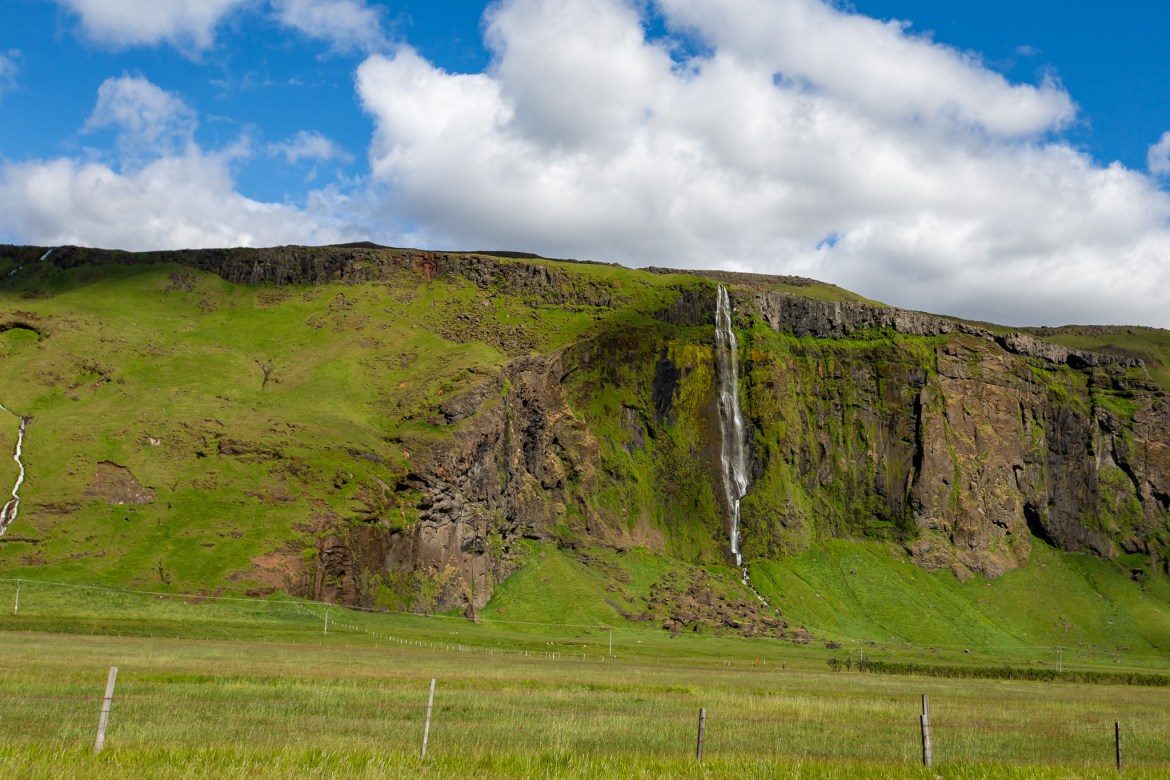
Uxafótafoss tumbles in several stages through the green cliffs just east of Vík along Iceland’s Ring Road.
Two Icelandic horses graze together among the summer grass and wildflowers of the Icelandic countryside.
A broad stand of purple lupines fills the riverbank beside the rushing Brúará beneath a bright summer sky.
The Brúará squeezes through dark volcanic rock at Hlauptungufoss before continuing downstream through the Icelandic countryside.
Rusted chain and heavy metal hardware show the effects of years exposed to salt air and Icelandic weather at Dyrhólaey.
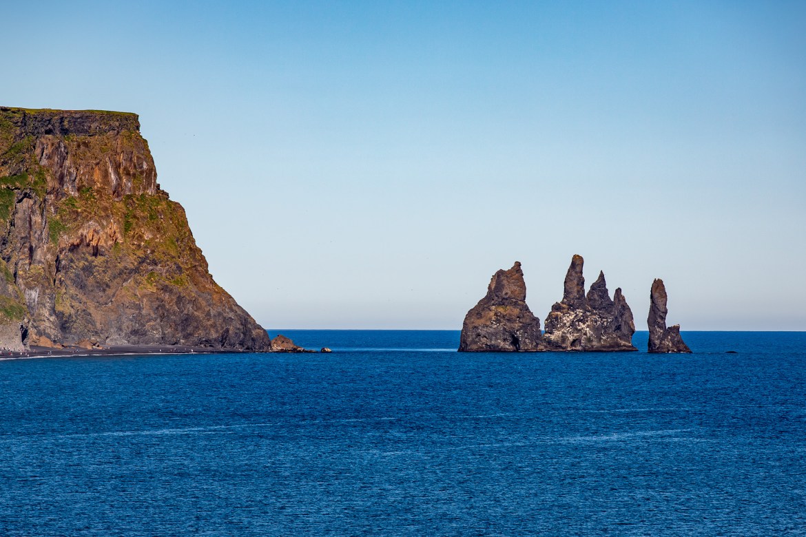
Waves wash against the weathered volcanic rock along the rugged shoreline of Dyrhólaey.
A rainbow forms in the heavy spray at the base of Skógafoss as sunlight reaches the waterfall from across the valley.
Photography Notes
This trip was made before my current Canon mirrorless setup.
I carried two Canon EOS 5D Mark III bodies almost everywhere. My normal setup was the 24–70mm f/2.8 on one body and the 70–200mm f/2.8 on the other, which meant I could switch focal ranges immediately without constantly changing lenses in Iceland’s wind, spray and volcanic environment.
The 16–35mm f/2.8 stayed in the bag for the wider scenes, and I carried a DJI Mavic 2 Pro, tripod, triggers, batteries and enough other gear to make the Lowepro AW350 earn its keep. I still use that bag today.
Waterfalls were obviously a huge part of the trip, so filters and long exposures came into play constantly. Kirkjufellsfoss, Hraunfossar, Brúarfoss and many of the smaller cascades gave us opportunities to slow the water and work moving clouds into the composition instead of simply shooting everything at fast shutter speeds.
Strokkur was the opposite. I treated that more like sports photography—high-speed burst, finger on the shutter and wait for the eruption.
The drone completely changed how I photographed Iceland. At the time, flying there felt considerably less restrictive than what I was accustomed to in the United States, and I used it heavily around waterfalls, lava fields, coastline and lighthouses. There were still aviation and site restrictions, so I wouldn’t describe 2019 Iceland as literally having “no drone rules.” The freedom simply felt dramatically different from what I was used to. Current Icelandic rules are considerably more formalized, and anyone recreating this trip should check the rules that apply now rather than treating my experience as guidance.
The horses also taught me something quickly. One drone flight clearly bothered them even though I was fairly high, so I backed off. From then on, animals got space and the drone went back to landscapes.
The green glass façade of Harpa Concert Hall catches the sunlight along Reykjavík’s waterfront.
The natural rock arch at Dyrhólaey opens toward the blue North Atlantic, surrounded by dark volcanic cliffs and green grass.
The summer sun shines through the spray from behind Seljalandsfoss, illuminating the water as it falls past the rocky overhang.
A dandelion and small yellow wildflowers grow beside the trail near Gullfoss during Iceland’s short summer season.
Looking downstream, the cold blue water of the Brúará churns over the rocky riverbed between banks covered in summer vegetation.
A gray Icelandic horse looks directly toward the camera while the rest of the herd grazes behind it.
The Hvítá River surges through the narrow volcanic gorge at Barnafoss, its pale blue water squeezed between dark lava walls.
Practical Notes & Lessons Learned
Iceland deserved more planning than I gave it.
Google Maps was remarkably good most of the time—even when the “road” looked questionable—but Brúarfoss proved that map data can lag behind changing access. The route we followed had already become a private-property problem before our trip. I wouldn’t repeat that approach today, and I certainly wouldn’t recommend anybody else do it.
Reykjavík deserved more attention too. Missing Hallgrímskirkja because two photographers were more interested in getting back to waterfalls is funny now, but I’d correct that on another visit.
Food and fuel also need more planning than we gave them. We could go long stretches outside Reykjavík without seeing much of either, and operating until midnight doesn’t help when businesses operate on normal schedules even if the sun doesn’t.
The expensive rental-car coverage also made more sense after seeing Icelandic roads. Gravel and sand/ash protection are still common Iceland-specific rental add-ons because those really are different risks than most American renters encounter at home.
And finally, Icelandic summer daylight can completely wreck your sense of time.
For photographers, that’s fantastic.
For sleep, not so much.
The Journey in Motion
I carried the Mavic 2 Pro throughout the trip and also recorded video on my phone, especially around the waterfalls, geothermal areas and some of the longer stops.
Iceland was made for aerial video. From the ground you see a waterfall, river or lava field. Get the drone in the air and suddenly you see how all of it fits together — rivers cutting through volcanic terrain, waterfalls hidden in the landscape and roads stretching through areas that seem completely empty.
These three videos cover some of my favorite parts of the trip and give a better sense of the scale than still photos can sometimes manage.
Waterfalls & Rivers Some of my favorite waterfall footage from the trip, including Hraunfossar, Barnafoss and the bright turquoise water around Brúarfoss. Iceland has no shortage of waterfalls, but each one seemed completely different from the last.
Geothermal Iceland & the Coast Steam, geothermal fields, moss-covered landscapes and the rugged Atlantic coastline. This video pulls together some of the places that made Iceland feel completely different from anywhere I had photographed before.
Iceland from the Air The Mavic 2 Pro got plenty of use on this trip. This video brings together aerial footage of waterfalls, rivers, volcanic terrain, cliffs and the wide-open landscapes that made me keep finding excuses to put the drone back in the air.
I’m Steve—a retired Army vet who traded rucksacks for camera bags and never stopped exploring. What started with a simple 110 film camera grew into photographing all 50 states and 30+ countries, from quick business-trip detours to adventures with my wife Laura. Shutter Nomadica is where I share those travels through the photographs, stories, and moments that made each place memorable.
Med-retired Army vet turned corporate road warrior. NC State biz/IT/HR grad. 36 countries, 50 states—still chasing that perfect frame with a Canon R5 Mark II + 24-105 f/2.8 strapped to the carry-on. Published shooter, start-up survivor, husband since 11·13·93, dad of two grown women, granddad x 2. ✈️ 📸 🏆